We’ve mapped about 25% of the ocean floor in any real detail. That means roughly 75% of Earth’s surface beneath the waves is less explored than the far side of the Moon. Mountain ranges down there taller than the Alps that we’ve barely photographed. Ecosystems around hydrothermal vents running on chemistry instead of sunlight. Potentially trillions of dollars in mineral deposits. And creatures that look like they were designed by someone who’d never actually seen an animal before. The ocean floor is, by almost any measure, the last major frontier on this planet.
About 71 percent of this planet is covered in ocean. Ninety-seven percent of all Earth’s water sits there. It controls the climate, produces more than half the oxygen we breathe, and holds ecosystems so bizarre they’d look at home in a science fiction film. Yet for most of modern history, the deep sea got treated like a basement nobody wanted to clean out, dark, cold, irrelevant. That’s been changing, though. Submersible tech, autonomous drones, and sonar systems have gotten good enough that we’re finally pulling back the curtain on what might be the strangest place any human has ever pointed a camera.
Why the Ocean Floor Stayed Hidden So Long
Pressure. That’s the short answer. At the bottom of the Mariana Trench, deepest point in any ocean, you’re looking at roughly 15,750 pounds per square inch pushing in on you from every direction. Over a thousand times atmospheric pressure at sea level. A human body wouldn’t last a fraction of a second. A regular submarine would crumple like a paper cup. And it’s completely dark down there. Sunlight gives up at around 1,000 meters. Below that, nothing but black water and cold hovering just above freezing.
People like to compare ocean exploration to space exploration, and the comparison actually makes the ocean look harder. Space is a vacuum. You engineer for zero external pressure, radiation, temperature swings, hard problems, sure, but well-understood ones with decades of solutions behind them. The deep ocean throws crushing omnidirectional force at you that increases with every meter of descent, plus corrosive saltwater, zero visibility, and a surface so far away that if something goes wrong, nobody’s coming to help. Twelve people walked on the Moon before two people reached the bottom of the Mariana Trench. That ratio says something.
Money didn’t help either. Oceanographic ships cost a fortune to build and operate. One deep-sea expedition can eat through millions in ship time, fuel, maintenance, crew. Governments, from what I’ve seen, have almost always preferred spending on space: it photographs better, generates more political excitement, and the military applications are more obvious. Ocean science got the leftovers. That funding gap is only recently starting to close.
The Mariana Trench: Going Down
January 1960. Jacques Piccard and Don Walsh climbed into the bathyscaphe Trieste and dropped to the Challenger Deep, roughly 10,935 meters below the surface. They spent maybe twenty minutes at the bottom, squinting through a small porthole at a cloud of stirred-up mud. Piccard thought he saw a flatfish. That claim’s been argued about ever since. Then they came back up.
And nobody went back for over fifty years.
James Cameron made his solo dive in 2012 aboard the Deepsea Challenger, spending around three hours collecting samples on the bottom. But the person who really cracked the hadal zone open, that’s the ocean layer below 6,000 meters) was Victor Vescovo. Between 2018 and 2019, he ran the Five Deeps Expedition, piloting the submersible DSV Limiting Factor to the deepest point in each of the world’s five oceans. He hit the bottom of the Mariana Trench in April 2019 at 10,928 meters.
What made his dives different wasn’t depth alone. It was that the sub could do it again. And again. Triton Submarines built the Limiting Factor with a titanium pressure hull designed for repeated full-ocean-depth dives, not a single dramatic plunge followed by a museum display. Vescovo dove the Challenger Deep multiple times. Dozens of scientists and explorers have used the sub since then. Going from one-off stunt to reusable research platform, that’s the shift that matters.
They found something troubling down there alongside the biology. Plastic. A plastic bag. Candy wrappers. Sitting at nearly 11 kilometers below the surface of the Pacific. Our garbage reached the deepest place on Earth before our scientists did.
Hydrothermal Vents: Life Where It Shouldn’t Be
Before 1977, every biologist on the planet would’ve told you the same thing: all life depends on sunlight. Photosynthesis sits at the bottom of every food chain. Period. Then a crew aboard the submersible Alvin found hydrothermal vents along the Galapagos Rift, and that whole framework fell apart.
Picture cracks in the seafloor blasting out water heated to over 400 degrees Celsius, loaded with dissolved minerals and hydrogen sulfide. Around those cracks, thriving communities. Giant tube worms stretching past two meters. White crabs. Dense beds of mussels and clams. Shrimp with light-sensing organs on their backs instead of eyes. None of them cared about sunlight. Chemosynthetic bacteria formed the base of their food chain, pulling energy from the chemicals in the vent fluid instead of from the sun.
I think this might be one of the most significant biological discoveries of the twentieth century. Not just for marine science, for how we think about life anywhere. If organisms can thrive in superheated, sunless, high-pressure environments running on chemical energy from a planet’s interior, then maybe life could exist beneath the ice shells of Europa or Enceladus. Similar conditions might exist on those moons. The deep ocean on our own planet became a test case for astrobiology, which is a strange thing to say about a place most people never think about.
Since that first discovery, hundreds of vent fields have turned up along mid-ocean ridges, back-arc basins, and submarine volcanoes all over the world. Each one seems to host its own community of organisms, many of them brand new to science. Along the Mid-Atlantic Ridge alone, researchers have found species that exist nowhere else: adapted to conditions so specific that moving a few meters in any direction means the difference between a thriving colony and empty rock.
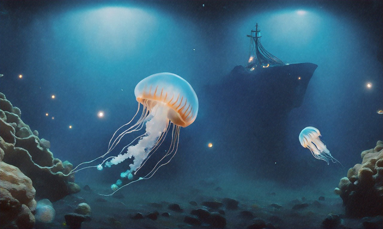
The Creatures of the Abyss
One of the biggest misconceptions people carry around is that the deep ocean is empty. Some barren underwater desert. It’s not. Strange, yes. Sparse in places. Profoundly alien-looking. But alive.
Take the barreleye fish, Macropinna microstoma. Transparent head. Fluid-filled dome for a skull. Its tubular eyes can rotate upward through the dome to spot the silhouettes of prey above it, or forward to see where it’s going. Or consider the dumbo octopus, which flaps little ear-like fins to move through water at depths past 4,000 meters; it’s been spotted as deep as 7,000 meters, deeper than any other known octopus. Then there’s the fangtooth fish. Teeth so big relative to its body that its mouth can’t fully close. Ever.
Giants live down there too. Giant isopods (deep-sea cousins of the common pill bug, grow past 50 centimeters. Giant squid have been the stuff of legend for centuries, but Japanese researchers only captured the first photographs of a live one in the wild in 2004. First video came in 2012. We’ve known about these animals forever. We still barely understand them.
Go deeper and things get stranger. The hadal zone, below 6,000 meters, is home to snailfish — small, translucent, gelatinous creatures filmed swimming past 8,000 meters down. Soft, flexible bodies that probably help equalize the pressure. There are also xenophyophores, single-celled organisms that can grow to 20 centimeters across. Single cells, 20 centimeters. Among the largest individual cells known on Earth. They carpet sections of the abyssal plains, feeding on organic particles drifting down from above like a slow, endless snowfall.
The deep ocean isn’t a void. It’s a world running by rules we’re only starting to figure out, where darkness is default, pressure is just part of life, and the boundaries of what counts as “possible” stretch wider than anyone assumed.
Mapping What Nobody’s Seen
For most of history, measuring how deep the ocean was meant dropping a weighted rope over the side of a ship and waiting. This was called sounding. It was exactly as slow and imprecise as it sounds (no pun intended, but there it is). One measurement could take hours. And it only told you the depth at that single tiny point. Mapping everything this way would’ve taken centuries.
Multibeam sonar changed the game. A multibeam echosounder sits on a ship’s hull and fires a fan of acoustic beams downward. They bounce off the seafloor and return. By measuring travel time and angle for each returning signal, the system builds a detailed bathymetric map of whatever’s below. One pass of a modern research vessel can cover a swath several kilometers wide, picking up features as small as 100 meters across. Not bad.
But ships are slow. Fuel costs money. And the ocean is enormous. Mapping every square kilometer at a resolution matching what we’ve got for Mars would take an estimated 350 ship-years of continuous surveying at current rates. That’s where Seabed 2030 comes in, a joint project between the Nippon Foundation and the General Bathymetric Chart of the Oceans (GEBCO), aiming to produce a complete map of the entire ocean floor by 2030. When the project launched in 2017, only about six percent of the seabed had been mapped with modern sonar. As of early 2026, that number’s up to roughly 28 percent. Real progress. Still a long way to go, though.
Autonomous underwater vehicles, AUVs, are speeding things up. Torpedo-shaped robots that dive deep, follow pre-programmed routes, and collect sonar data without a human crew onboard. Some stay submerged for days. Others get launched from uncrewed surface ships that can operate for months without returning to port. Autonomous surface vessels deploying autonomous submarines. It’s a force multiplier that could cut the mapping timeline down considerably.
Satellites offer another angle. By measuring tiny variations in sea surface height caused by the gravitational pull of underwater mountains and ridges, satellites can estimate seafloor topography from orbit. Resolution isn’t great, you can spot a seamount, but you’ll miss the smaller stuff) yet it provides a rough framework for more detailed surveys to fill in later.
Robots Going Where People Can’t
Human-occupied submersibles like the Limiting Factor are incredible for observation and sample collection. They’re also expensive, risky, and limited. Remotely operated vehicles (ROVs, tethered robots controlled from the surface, have been deep-sea workhorses for decades, but the tether limits range and the ship has to sit right overhead. Not ideal for covering large areas.
AUVs are the next step. Vehicles in the Kongsberg HUGIN series, for example, operate at depths up to 6,000 meters, survey for 24-plus hours on a single battery charge, and carry multibeam sonar, sub-bottom profilers, cameras, and chemical samplers. No cable. No pilot. They follow their mission plan, gather data, and come back up.
Some designs are pushing even deeper. The Hadal Exploration Vehicle uses ceramic pressure housings and energy-efficient propulsion to survive at full ocean depth. Soft robotics is another promising direction: designs inspired by the flexible, pressure-resistant bodies of deep-sea jellyfish and octopuses. In 2021, Chinese researchers demonstrated a soft robot swimming at nearly 11,000 meters in the Mariana Trench, powered by artificial muscles that expand and contract with electrical signals. A soft robot. At the bottom of the ocean. That’s not science fiction; it happened recently.
These machines aren’t replacing human curiosity. They’re carrying it into places where human bodies just can’t survive for any useful length of time. As the sensors get better and the batteries last longer, we’ll probably start seeing footage from regions no eye, biological or electronic, has ever observed.
What’s Down There: Resources, Risks, and Surprises
More mapping means more discoveries, and some of them are unsettling. Submarine volcanoes erupt on a regular basis, often without anyone on the surface noticing. Underwater landslides shift huge volumes of sediment and can trigger tsunamis. Methane seeps, spots where the greenhouse gas bubbles up from the seafloor) turn out to be far more widespread than earlier estimates suggested. What that means for climate models is still being worked out.
Then there’s the mineral wealth. Polymetallic nodules cover vast stretches of the abyssal plains, especially in the Clarion-Clipperton Zone of the central Pacific. Potato-sized lumps containing manganese, nickel, cobalt, and copper, metals that matter for batteries, electronics, and renewable energy infrastructure. Deep-sea mining companies have had their eye on these deposits for years. Some hold exploration licenses from the International Seabed Authority.
But pulling those nodules off the bottom carries serious environmental risks, and I’m not sure we’ve done enough homework yet. The abyssal ecosystems around nodule fields are poorly understood. Removing the nodules would destroy habitat that took millions of years to develop. Sediment plumes from mining equipment could drift over hundreds of kilometers, suffocating filter-feeding organisms far from the extraction site. Scientists have warned (repeatedly, that we don’t know enough about these ecosystems to predict the full fallout of disturbing them. The resources are real. The demand is real. But the cost of getting this wrong could be permanent.
Antarctica’s Hidden Seafloor
Some of the least explored ocean floor on Earth sits beneath the Southern Ocean around Antarctica. Icebergs, extreme weather, and sheer remoteness keep most survey ships away. The terrain under that water, though, is spectacular, submarine canyons, volcanic ridges, hydrothermal vent fields hosting species found nowhere else.
AUV deployments under Antarctic ice shelves have turned up landscapes nobody predicted. Beneath the Thwaites Glacier, nicknamed the “Doomsday Glacier” for its potential to raise global sea levels, researchers found warm water moving through channels carved into the underside of the ice. And it turns out the shape of the seafloor under that glacier matters enormously for how fast it melts. Ridges on the bottom can slow warm water from getting in. Valleys speed it up. This isn’t abstract geology. It’s data we need to predict how fast coastlines will flood in the coming decades.
Antarctic vent fields have delivered biological surprises too. Yeti crabs, hairy, blind crustaceans) cluster around vents on the East Scotia Ridge, farming bacteria on their bristly arms. Nobody knew they existed before 2010. There’s every reason to believe more species are waiting in unexplored Antarctic waters, going about their business in total darkness, completely indifferent to whether we ever show up.
Talking Through Water: The Communication Problem
Radio waves don’t work in the ocean. They get absorbed almost instantly by seawater. GPS signals can’t penetrate below the surface either. So any vehicle or sensor operating deep underwater is basically cut off from real-time contact with anything above unless it’s connected by a physical cable. That’s a big limitation.
Acoustic communication (using sound waves, is the main workaround, but it’s slow. Sound travels well in water, about 1,500 meters per second, roughly four times faster than in air. But the data rates you can get out of current acoustic modems are tiny by modern standards. Sending a single high-resolution photo from an AUV to a surface ship can take minutes. Real-time video streaming? Not happening without a tether.
Some researchers are experimenting with optical communication, focused beams of blue or green light, wavelengths that seawater absorbs less than others, to get higher data rates over short distances. There’s also growing interest in building underwater networks: arrays of acoustic relays and sensor nodes that could function as a kind of deep-sea internet, allowing continuous monitoring and faster data transfer. But we’re probably years away from anything resembling the connectivity people take for granted on land. Maybe decades.
Climate, Medicine, and Cables Under the Sea
This isn’t just about satisfying curiosity, though honestly that alone would be worth the effort. Understanding the ocean floor connects directly to human survival in ways most people don’t consider.
The ocean absorbs roughly 30 percent of the carbon dioxide humans produce. It captures more than 90 percent of the excess heat trapped by greenhouse gases. How long it can keep doing that, and what happens if it stops) depends partly on processes happening at the seafloor. Deep-water circulation. Sediment chemistry. Methane hydrate stability. The biological carbon pump, which is the process by which organic material sinks from the surface to the deep ocean and stays there. All of it feeds into climate projections that governments are using to make policy right now.
Deep-sea organisms are also a mostly untapped source of bioactive compounds with medical potential. Compounds from marine sponges, sea squirts, and deep-water bacteria have shown promise against cancer, antibiotic-resistant infections, and inflammatory diseases. Remember Taq polymerase, the enzyme that made PCR testing possible? It came from a heat-loving bacterium found in a terrestrial hot spring. Hydrothermal vent organisms could harbor biochemically useful stuff we haven’t even imagined yet. Hard to develop what you haven’t found.
And there’s the practical hazard side. Submarine earthquakes and volcanic eruptions trigger tsunamis. Underwater landslides can sever the fiber-optic cables that carry roughly 95 percent of intercontinental data traffic. Better seafloor maps mean better hazard prediction, smarter cable routing, and earlier warnings. The practical payoff from all this mapping work is enormous, even if it doesn’t make headlines.
Money, Machines, and a Different Kind of Race
Something shifted in the last few years. More money is flowing into ocean science, not just from governments, but from private philanthropy and commercial ventures. Vescovo’s expeditions showed that the private sector can push into territory that used to belong only to national agencies. Organizations like Ocean Exploration Trust, Schmidt Ocean Institute, and the XPRIZE Foundation are funding expeditions, building new tech, and releasing data publicly in ways that would’ve seemed impossible twenty years ago.
The XPRIZE Shell Ocean Discovery competition wrapped up in 2019. It challenged teams to build autonomous systems that could map the seafloor at high resolution and capture detailed underwater images. The tech that came out of that contest is now being refined and deployed in actual research programs. Set an ambitious target, offer a prize, let diverse teams compete. It seems to work.
Data from Seabed 2030 and related mapping projects is being released freely through the GEBCO global bathymetric grid. Anyone with an internet connection can download and explore seafloor terrain that, a generation ago, was either classified or simply didn’t exist. That openness is pulling new talent into a field that’s struggled for attention for as long as it’s been around.
We live on an ocean planet. Always have. But we’ve spent most of our technological history aiming upward instead of downward. The instruments and vehicles to change that are here now: and whatever’s waiting on the ocean floor could end up mattering just as much as anything we find orbiting distant stars. Whether we explore it wisely, with enough care to protect what we find and enough ambition to keep going deeper, is the part that isn’t settled yet.


(0) Comments